
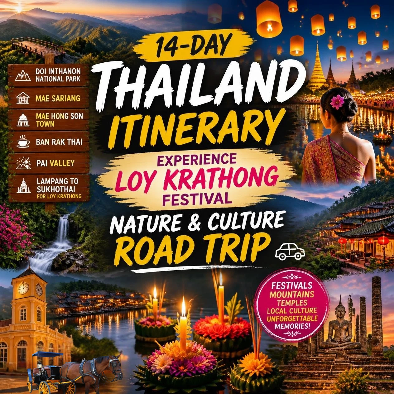
Northern Thailand is defined by a dramatic geography that served as the forge for the Lanna and Siamese kingdoms. Strategically, this route encompasses the legendary “Mae Hong Son Loop” before tracking south into the historical heartlands of Sukhothai culminating with the Loy Krathong festival. Your journey follows not only Thai heritage, but fittingly for Loy Krathong the flow of water.
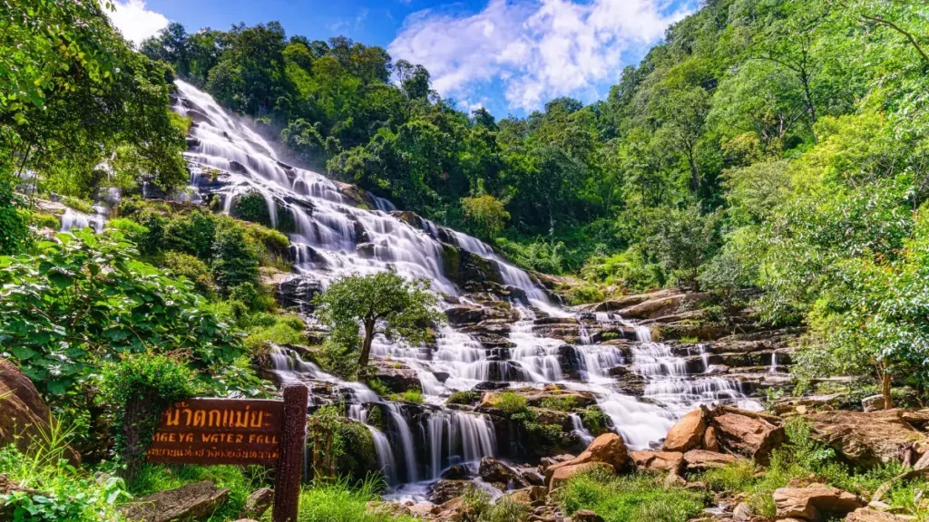
Starting from Thailand’s highest peak Doi Inthanon, through rivers and falls of the mist-shrouded mountains all the way to the canals and moats found in the architectural birthplaces of the Thai nation Sukhothai. To navigate this terrain is to witness the evolution of Southeast Asian power and history through its shifting landscapes.
Loy Krathong Festival Self Vehicle and Licensing
Deciding on a self-drive road trip in this region requires specific logistical transport preparations. The main circuit covers approximately 600 kilometers, though with essential detours to Ban Rak Thai and Doi Inthanon, the total distance expands to roughly 800 kilometers.
Self-Drive Road Trip Tips
What You Need To Know!
- License: You must have your original national driving license and an International Driving Permit (IDP) from your home country, as both are required for legal driving in Thailand
- Cars: Recommended for those prioritizing safety and climate control. While the roads are well-paved and do not strictly require 4WD, high-clearance vehicles offer better visibility.
- Motorbikes: For experienced riders, a 150cc engine or higher is mandatory. The Honda Click 160i or Yamaha NMAX 155 are the specialist choices for scooters, while the Honda CB300R or Honda NX500 are recommended for those requiring engine braking for technical descents.
- Rental Protocols: Reliable agencies in Chiang Mai offer insurance. Check it includes First Class coverage (covering both your rental vehicle and third-party liabilities).
- Never leave your original passport as a deposit if you can avoid it. It is your primary ID. Always inquire beforehand about using a copy of your passport alongside a security deposit.
Mae Hong Son Loop The “1,864 Curves” Reality
The technicality of Northern Thailand’s roads is world-renowned. Driving the Mae Hong Son Loop is a bucket-list experience, but demands constant attention. The segment between Chiang Mai and Mae Hong Son features exactly 1,864 cataloged curves. These aren’t gentle corners. We are talking tight hairpin switchbacks. Make sure to treat each as such and focus on mastering the blind curves.
Always watch for oncoming traffic. On blind curves, oncoming cars and trucks often cross the centerline. Always stay tight to the left and expect the unexpected. When planning always consider realistic journey times. Due to the roads tight corners and steep descents, average speeds rarely exceed 20-25 miles per hour (30–40 km/h). A good rule of thumb average is expect a 60 mile stretch to require at least three hours of active driving time.
Travel Season
When Should I Drive The Mae Hong Son Loop?
- The Cool Season (November–January): Loy Krathong Season and the ideal window! Visibility is high, and the weather is manageable.
- The Burning Season (March–May): Strictly avoid. Agricultural burning results in heavy smoke, impacting health and obscuring panoramic vistas.
- The Rainy Season (June–October): Offers lush greenery but requires caution due to slippery road surfaces on technical mountain passes.
Want to Book Your Vehicle Now?
First Time Visitors To Chiang Mai – The Seat Of Lanna Power
This will add 2 days to your 14 day itinerary as Chiang Mai isn’t included in this road trip. If however it’s your first time here it’s well worth spending a day or two to visit the sights! Our Loy Krathong festival itinerary is tailored to use Chiang Mai as entry and exit point. So if you decide to add Chiang Mai here’s what to see! (or check out our bespoke North to South Thailand Itinerary which has a detailed Chiang Mai destination guide).
Chiang Mai Sacred Geographies
Must Do Activities
- Wat Chiang Man: Your first stop must be the city’s oldest temple, founded in 1296 by King Phaya Mangrai. It houses the Phra Setangkhamanee (Crystal Buddha) and features the “Chang Lom Chedi,” where 16 stucco elephants encircle the base.
- Wat Phra That Doi Suthep: Situated at 1,060 meters, this is the region’s spiritual pinnacle. Reachable via a 306-step Naga staircase, its architecture is a dazzling display of gold Lanna craftsmanship.
- Wat Phra Singh Woramahawihan: A 14th-century masterpiece exemplifying Lanna style with Burmese influences, housing the revered Phra Singh Buddha.
- Wat Chedi Luang: Once the largest structure in ancient Chiang Mai at 85m high, its massive, earthquake-scarred stupa remains a testament to the ingenuity of the Mengrai dynasty.
Urban Navigation and Evenings
In Chiang Mai head to the old city. Begin at Tha Phae Gate, which is the historical entry point to the Old City. Spend time browsing and take in the sights, sounds and tastes! In the evening, the Night Bazaar provides a focal point for cultural orientation and local handicrafts.
The “Monk’s Trail” and Hidden Gems
On Day 2 if you are feeling energetic I highly recommend a transition to the wild. This is a hike along the Monk’s Trail to Wat Palaad. This forest temple, nestled by a mountain stream, represents the “middle space” between urban Lanna authority and the rugged forest trails to follow. It’s an incredible hike. It is moderately challenging (heat and some parts are steep) but is accessible to all. Get our detailed guide to Thailand travel.
OK so now let’s look at our Loy Krathong Festival 14-Day “Nature & Culture” Self-Drive Loop Itinerary. Below is as quick look day plan. The detailed itinerary starts directly after it.
Loy Krathong Festival Self-Drive Loop Day Plan
| Day | Road Trip Travel | Key Activities and Experiences | Geographic and Road Conditions |
|---|---|---|---|
| Day 1 | Chiang Mai to Doi Inthanon | National Park exploration, Ang Ka trail, Twin Pagodas | Highway 108, Route 1009 gradual but sustained ascent |
| Day 2 | Doi Inthanon National Park | Kew Mae Pan trail | Highway 108, Route 1009 and Route 1192. High-altitude environment, steep descent on Route 1192 |
| Day 3 | Doi Inthanon to Mae Sariang & The Salawin River | A sleepy wooden town on the Yuam River, ancient teak wood temples, Salawin. | Follow Route 121, Route 119, Route 108 and Route 1194. Winding, Steep. |
| Day 4 | Salawin River | Monks collecting alms at dawn. Salawin National Park on the border of Myanmar. | Extreme vertical climbs; narrow border paths |
| Day 5 | Mae Sariang to Mae Hong Son Town | Drive north through spectacular mountain passes to the provincial capital | Follow Route 1194 to Route 108 to ms 5016 to 5035 |
| Day 6 | Mae Hong Son to Ban Rak Thai | Border Enclave, Reservoir boating, oolong tea tastings, Lee Wine Ruk Thai Resort | 5035 to 5016 to route 108 and ms 4001 |
| Day 7 | Ban Rak Thai | Take a bamboo raft through the massive Tham Lod Cave, a limestone cavern | MS4001 to toute 1095 and MS4014 |
| Day 8 | Ban Rak Thai to Outer Pai Valley | Drive the famous Route 1095 of the Mae Hong Son Loop towards Pai. Reverie Siam Resort | MS4001 to Route 1095 |
| Day 9 | Outer Pai Valley | Pai Canyon. Sai Ngam Natural Hot Springs, Lush rain forest. | |
| Day 10 | Outer Pai to Lampang | Wat Phra That Lampang Luang, Kad Gong Ta Market, Horse Carriage Ride, Baan Suchadaa Lampang Resort | via Route 1095 and Route 11 |
| Day 11 | Lampang | Thai Elephant Conservation Center | |
| Day 12 | Lampang to Sukhothai | via route 1 | |
| Day 13 | Sukhothai Historical Basin | Sukhothai during the day and then the main event! The Loy Krathong Festival and evening show between 7:00 PM and 10:00 PM on the night of the full moon of the 12th lunar month (November 25th 2026) | Flat agricultural plains; historic ruins |
| Day 14 | Sukhothai to Chiang Mai for departure | Drive back to Chiang Mai to return car and catch departure flight. The option exists to head south and depart Bangkok (but Bangkok is an additional 1 to 1.5 hours drive) | via Chiang Mai-Lampang Superhighway / Inburi-Chiang Mai Road (4-4.5 hours) |
Stay
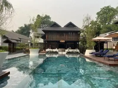
Aleenta Retreat Chiang Mai
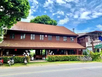
Riverhouse-The Teak House
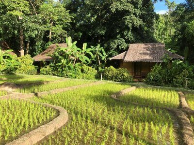
Fern Resort
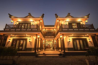
Longlai Kezhan

Reverie Siam Resort
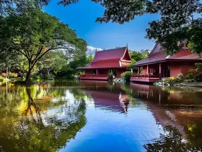
Baan Suchadaa Lampang Resort
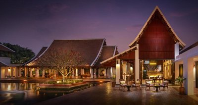
Sukhothai Heritage Resort
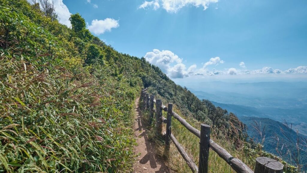
Kew Mae Pan Trail
Doi Inthanon offers numerous nature trails, but Kew Mae Pan is the most popular. The trail is approximately 3.2 kilometers long and takes about 2–4 hours to complete. All groups must be accompanied by a Karen Hill Tribe trekking leader. You will be allocated a guide at the entrance.
Along the route, you will see rhododendrons, plants commonly associated with the Himalayas. The trail winds through cool, moist environments and lush valleys. At elevations above 2,000 meters, the forest is covered with lichens and wild orchids, while indigenous plants flourish in nutrient-rich organic soil.
Located approximately 2,200 meters above sea level, Kew Mae Pan passes through three distinct forest types and features 21 interpretive zones. Each zone provides detailed information about the area’s plants and ecosystems, including ancient ferns, Himalayan species, dense cloud forests, and open grasslands.
Forest Type 1 – Ancient Evergreen Forest
Zone 1: Forest Floor
The first zone is a tranquil evergreen forest filled with ancient filmy ferns. The dense canopy allows very little sunlight to reach the forest floor, where fallen leaves and organic matter decompose slowly because of the cool climate. This process helps preserve the area’s pristine environment. The forest also serves as an important watershed, capturing moisture from the clouds and providing a habitat for rare plant species, including Himalayan rhododendrons and wild orchids.
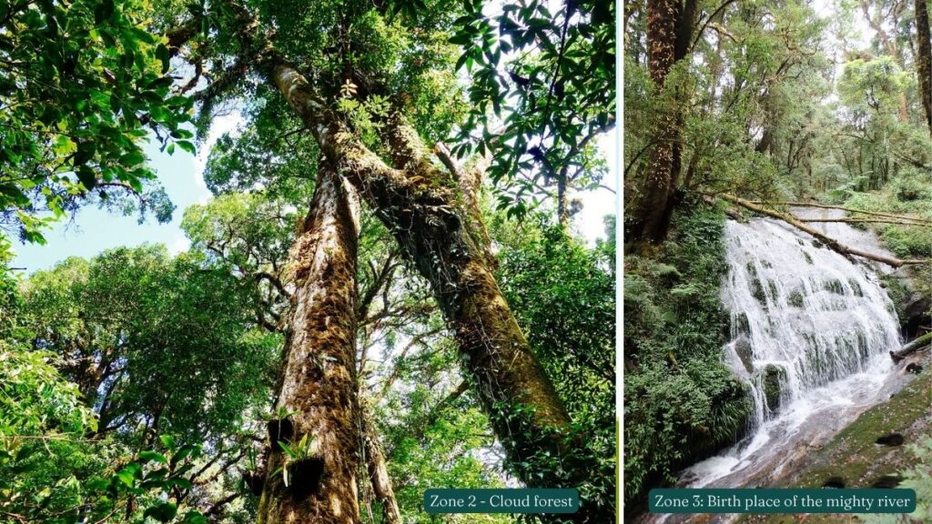
Zone 2: Cloud Forest
As you climb higher, the trail leads into the cloud forest, where temperatures fall and clouds develop, supplying essential water through condensation. This ecosystem features a dense canopy set apart from the undergrowth and supports numerous epiphytes, such as orchids and ferns, which grow on nearly every trunk and branch.
Zone 3: Birth place of the mighty river
You’ll see a deep gorge where a mountain stream once flowed. As streams flow over rocks, they absorb oxygen and help support the watershed. All streams in this area eventually flow into the Ping River, which joins the Chao Phraya River and provides water for millions of people in Thailand’s central plains.
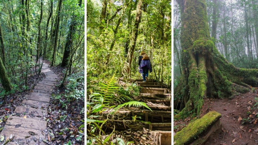
Zone 4: Plant Communities of the Cloud Forest
Showcasing the cloud forest’s diverse plant communities. Tropical oaks and Schima wallichii are the dominant trees. The rich, boggy, acidic soil supports many ground-cover plants, especially those in the ginger family. However, few seedlings grow where the leaf litter is too thick, highlighting the ecosystem’s delicate balance.
Zone 5: The Dynamic Nature of the Forest
High-altitude cloud forests like this one face strong winds that sometimes knock down trees. The gaps let in sunlight and encourage new growth. Non-woody plants thrive before the original trees gradually reclaim the area. This natural cycle of disturbance and recovery helps maintain the forest’s biodiversity.
Zone 6: Vines
Learn how vines quickly climb trees to reach the canopy. Their aerial pathways help squirrels, civets, and other animals move between trees, showing the cloud forest’s interconnected ecosystem.
Forest Type 2 – Alpine Meadows
Zone 7: Sub-Alpine Meadow
The trail reaches a rare sub-alpine meadow at 2,000–2,500 meters. Poor soil, steep slopes, and frequent fires prevent forests from returning, allowing hardy Himalayan plants to thrive. Here, grassland continues to prevail over forest.
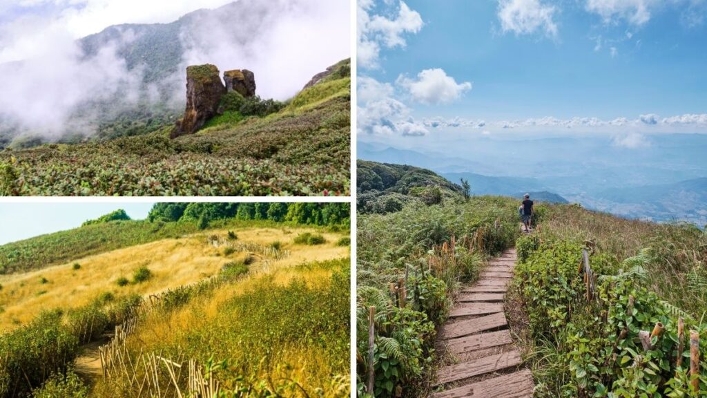
Zone 8: Bracken Ferns
Bracken ferns thrive in damp gullies and withstand dry, windy conditions and fires. Their thick leaves reduce water loss, while underground stems protect them and support rapid regrowth.
Zone 9: Grassy Summit
One of the trail’s highlights is the panoramic viewpoint offering sweeping views of the Doi Inthanon mountain range. The constantly shifting clouds give the scenery a mystical feel, making it an ideal place for reflection and photography. Whether the landscape is covered in mist or glowing in sunlight, the views are always breathtaking.
Zone 10: Rocky Cliffs
These rocky cliffs provide a natural habitat for gorals, small goat-like animals perfectly suited to the rugged surroundings. Their gray-brown coloring blends with the boulders, making them hard to see unless you look carefully. The cliffs offer protection from predators, while the gorals’ sure footing helps them move easily across the steep terrain.
Zone 11: Phar-Ngam Noi rock outcrop
The Phar-Ngam Noi rock outcrop is a remarkable geological formation shaped by centuries of erosion. Its two granite rocks reflect the lasting power of wind and water, which have gradually worn down the surrounding landscape. The outcrop highlights the natural forces that have been continuously reshaping the earth in the region for millennia.
Zone 12: The Kew Mae Pan Mountain Ridge
Kew Mae Pan ridge contrasts lush sheltered forest with stunted trees exposed to strong winds and sunlight, separating two ecosystems and showing the forest’s adaptability.
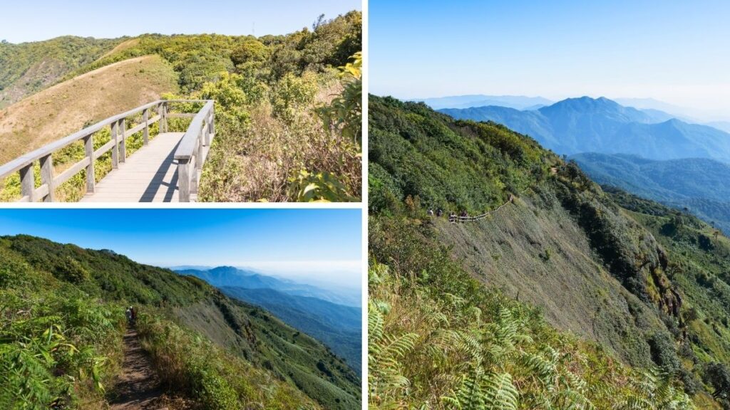
3rd Forest Type – Secondary forest
Zone 13 – 21:
Passing back through the zones Grassy Summit to Forest Floor, but on the sunny side of the ridge. You’ll spend time observing pioneer species of sun-loving plants, such as reeds and bananas, thrive. Further down you’ll see the giant trees at Zone 18 which have shallow root systems that extend horizontally just beneath the surface. These roots help support the trees in the thin, rocky soil, but they also leave them vulnerable to toppling during storms.