

Last updated August 22, 2026
I’ve now spent enough time exploring Thailand off the beaten path by night train, songthaew, and rented Honda Wave to say this plainly: the country most people describe when they say “Thailand” — full-moon parties, Phi Phi speedboats, Chiang Mai’s Sunday Walking Street shoulder to shoulder — is maybe a fifth of the actual country.
The other four-fifths is Isaan farmers cycling home past thousand-year-old Khmer sandstone, a province called Nan where I went four days without hearing another non-Thai voice, and a waterfall so far into the hills that reaching it means three hours on an inflatable raft before you’ve even started walking.
None of what follows is secret. Thai people go to all of these places constantly — Phanom Rung gets more Thai visitors on a Sunday than foreign ones all month, and Chiang Khan is a bona fide domestic weekend-break town. What’s rare is foreign independent travelers, and that changes the texture of a trip: fewer set-menu tourist restaurants, more places where someone will sit down at your table uninvited to practice English, and logistics that reward planning rather than punishing improvisation.
This is a destinations hub page, not a single itinerary. I’ve picked seven regions that hold up to real scrutiny — accessible without a tour operator, distinct enough from each other that you’re not just doing the same trip twice, and currently under-visited by international travelers rather than merely marketed that way. Each section links to a full standalone guide. Below that, I’ve put everything I wish someone had told me before I went: current visa rules, what a train ticket actually costs, and — because I’d rather you hear it from me than find out at a checkpoint — an honest rundown of where Thailand’s current border situation with Cambodia and its long-running southern insurgency actually affect travel planning, and where they don’t.
Thailand Off The Beaten Path Quick Answers
- Best under-the-radar regions in 2026: Isaan (northeast Khmer temples and Mekong towns), Nan province, the Mae Hong Son motorbike loop, Sangkhlaburi, Um Phang/Thi Lo Su waterfall, Koh Kood and Koh Mak (Trat archipelago), and Koh Libong and Koh Sukorn (Trang Andaman islands).
- Visa-free stay: As of August 2026, most Western passport holders still get 60 days visa-free on arrival, but Thailand’s Cabinet approved cutting this to 30 days on May 19, 2026. The change takes effect 15 days after publication in the Royal Gazette, which had not happened as of this writing — check current status before booking. A free Thailand Digital Arrival Card (TDAC) is required online within 72 hours of arrival regardless.
- Best time to go: November through February for almost everywhere in this guide — cooler, dry, and clear. March–April brings burning-season haze to the north (Nan, Mae Hong Son). May–October is wet season on both coasts and in the northeast, though rain tends to fall in short evening bursts rather than all day.
- Border safety in 2026: Land crossings between Thailand and Cambodia have been closed since June 2025 amid an active territorial dispute; a roughly 50km buffer along that border (parts of Sa Kaeo, Buriram, Si Sa Ket, Surin, Ubon Ratchathani, Chanthaburi, and mainland Trat) carries government advisories. Thailand’s three southernmost provinces — Yala, Pattani, Narathiwat — have a long-running separatist insurgency and are outside the scope of this guide. Full detail in the safety section below.
What “Off the Beaten Path” Actually Means Here
I’ll be upfront about my “off the beaten path Thailand travel” filter, because “hidden gem” gets slapped on places that see forty tour buses a day. I chose these seven on three criteria: you can get there and around without booking a guide, foreign tourists are genuinely uncommon (not “uncommon for Instagram” — actually uncommon), and there’s enough infrastructure that going independently is a reasonable decision rather than a survival exercise. That last point matters. Um Phang, further down, sits right at the edge of that line, and I say so.
Before You Go: The Practical Stuff
Visas and entry
Thailand’s visa-exemption rules have been in flux all year, and the situation as of this writing is genuinely mid-change. The 60-day visa-free stay for 93 countries and territories, introduced in July 2024, is technically still in force. Thailand’s Cabinet approved rolling it back to 30 days (with a 15-day exemption for Maldives, Mauritius, and Seychelles) on May 19, 2026, but that change only takes legal effect 15 days after it’s published in the Royal Gazette — and as of late August 2026, that publication hadn’t happened. The most up to date information as at 22 August 2026 can be found here.
Practically, your stay length is set by your actual arrival date, not your booking date, so if you’re reading this close to your trip, check the Thai Ministry of Foreign Affairs or your nearest Thai embassy site the week you fly, not months out. Everyone, regardless of visa status, needs to complete the free Thailand Digital Arrival Card online within 72 hours of arrival at tdac.immigration.go.th — it’s free, and any site charging you for it is a scam.
Money
Cash still runs rural Thailand — village guesthouses on Koh Sukorn, songthaew drivers in Nan, the noodle stall that’s actually the best meal you’ll have all week. Thai ATMs charge foreign cards a flat fee per withdrawal that’s crept up from the long-standing 220 THB to 250–350 THB at several major banks in 2026, charged regardless of how much you take out. So withdraw the maximum your bank allows in one go rather than making several smaller withdrawals — the fee is per transaction, not a percentage.
Always choose to be charged in Thai baht when the screen asks; accepting “your home currency” triggers Dynamic Currency Conversion, which quietly marks up the exchange rate. Outside provincial capitals, ATMs get sparse — stock up on cash before Um Phang, Koh Libong, or Koh Sukorn specifically, since none of them have a reliable ATM network you can count on.
Staying connected
A tourist eSIM from AIS or the merged True/dtac network activates before you land and covers you almost everywhere in this guide — AIS generally has the better rural signal outside major towns. Data-heavy tourist packages run roughly 300–1,200 THB depending on data volume and validity. Signal does thin out on the Mae Hong Son Loop’s mountain passes and in pockets of Um Phang; don’t assume you’ll have maps the whole way.
Getting around
For long hauls between regions, Thailand’s overnight sleeper trains are genuinely one of the better ways to move — a second-class air-conditioned sleeper from Bangkok to Chiang Mai or Nong Khai runs roughly 700–1,050 THB for a curtained berth with bedding included, and it beats a night bus for comfort by a wide margin. All long-distance trains now leave from Krung Thep Aphiwat Central Terminal in Bangkok (also called Bang Sue Grand Station) — Hua Lamphong, the old station everyone’s blog post still mentions, only runs short-haul and commuter trains now.
Book through the official State Railway of Thailand D-Ticket system or via 12Go Asia (which charges roughly a 100–200 THB service fee but has better English support). Long-distance sleeper tickets open 90 days before departure for routes covering most of a train’s total distance, and lower berths on the Chiang Mai and Nong Khai routes sell out within days during December–February high season — book that far ahead if your dates are fixed. Use the search widget below to get the best local prices from a highy recommended and totsally safe provider.
Within the regions in this guide, you’re mostly looking at songthaews (shared pickup trucks), minivans, and — for Nan, the Mae Hong Son Loop, and parts of Um Phang — a rented motorbike, for which you legally need an international driving permit with a motorcycle endorsement, even though enforcement is inconsistent. Rent from a shop that gives you a helmet without being asked and takes photos of any existing scratches before you ride off; motorbike accidents involving tourists are common enough that most travel insurance policies specifically exclude them unless you’re wearing a helmet and hold a valid license for the vehicle class.
Safety, honestly
I’d rather over-explain this than have you find out mid-trip. Thailand overall sits at the lowest advisory tier from most Western governments — Bangkok, Chiang Mai, Phuket, and the vast majority of what’s in this guide carry no special warnings. Two specific situations are worth knowing about before you plan a route through Isaan or the Trat islands:
The Thailand–Cambodia border. A territorial dispute escalated into armed clashes in 2025, and all seven official land border crossings between the two countries have been closed since June 2025, with no reopening date announced as of August 2026. A fragile ceasefire has held since December 2025, but various governments maintain advisories against travel within roughly 10–50km of the border itself, covering parts of Sa Kaeo, Buriram, Si Sa Ket, Surin, Ubon Ratchathani, Chanthaburi, and mainland Trat province.
This directly touches two things in this guide. First, in the Isaan section below, the Prasat Ta Muen Thom border temple — a genuine highlight in older off-the-beaten-path write-ups — sits essentially on the border itself, and unexploded ordnance has been reported in that specific area; I’m not including it as a destination here, and I’d skip it until the situation is fully resolved. Phanom Rung and Phimai, both further from the border, remain open and unaffected.
Second, Koh Chang, Koh Kood, and Koh Mak technically sit within the 50km advisory radius even though they’ve seen zero disruption — ferries run on schedule, hotels are open, life continues normally. The catch is insurance: because these islands fall under some governments’ “do not travel” advisory zones on a technicality, standard travel insurance may not cover medical evacuation there. Check your specific policy’s wording before you book, not after.
Southern Thailand. Yala, Pattani, and Narathiwat provinces, plus parts of southern Songkhla, have an ongoing, decades-long separatist insurgency that’s resulted in thousands of deaths since 2004, mostly in attacks directed at Thai security forces rather than tourists. This is genuinely a different part of the country from anything else in this guide — none of the seven destinations below go anywhere near it, and I’ve deliberately left the deep south out of this hub rather than write a “yes but” travel guide to an active low-level conflict zone.
If you’re curious about Betong specifically — the mountain town at Thailand’s southern tip that shows up in a lot of off-the-beaten-path lists — know that it has a genuinely different security profile from the rest of the deep south and sees regular domestic tourism, but it still sits inside most governments’ advisory zone with no local carve-out, which typically voids standard travel insurance regardless of Betong’s actual conditions on the ground. That’s a real decision to make with current information, not something I can responsibly wave through in a paragraph.
Away from those two specific situations, ordinary Thailand travel-safety advice applies: road accidents (particularly motorbikes) are a far bigger statistical risk than crime, drink-spiking happens at nightlife venues often enough to take seriously, and Thailand’s tourist police (dial 1155) handle visitor-specific issues in English.
When to go, region by region
Thailand doesn’t have one weather pattern — it has three or four running at once, and this matters more than usual for a guide this spread out.
- November–February is the safe default almost everywhere here: dry, cooler (especially at altitude — Nan and the Mae Hong Son Loop can dip into single digits Celsius at night), and clear skies. It’s also peak season, so book trains and island ferries ahead.
- March–April turns hot fast in the lowlands and brings agricultural burning-season smoke haze to the north — Nan and Mae Hong Son are genuinely worse for it, sometimes with air quality bad enough to affect visibility and respiratory comfort. This is also when Thi Lo Su waterfall in Um Phang is at its least dramatic, since the dry season means less water volume, even though road access is at its easiest.
- May–October is southwest monsoon season across most of the country. Isaan and the north get intense but usually brief evening downpours rather than all-day rain. The Trat islands (Koh Kood, Koh Mak) and Andaman coast (Trang islands) see their heaviest rain and roughest seas in this window — some inter-island ferries reduce service or stop entirely, particularly between Koh Kood and Koh Mak from May to October. Thi Lo Su, on the other hand, is arguably at its most spectacular in the rainy months when there’s real water volume, if you’re up for reaching it by raft rather than 4×4.
The Seven Regions
Isaan: Khmer Temples and the Mekong, Without the Crowds
Good for: history-minded travelers, road-trippers with a rental car, anyone who’s done Angkor and wants the quieter cousin next door
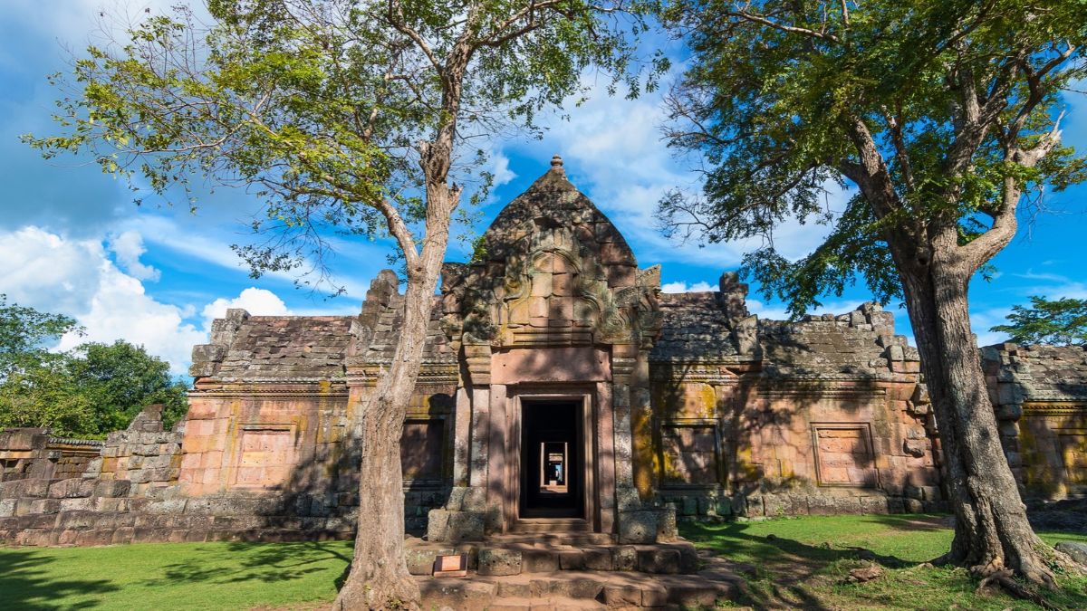
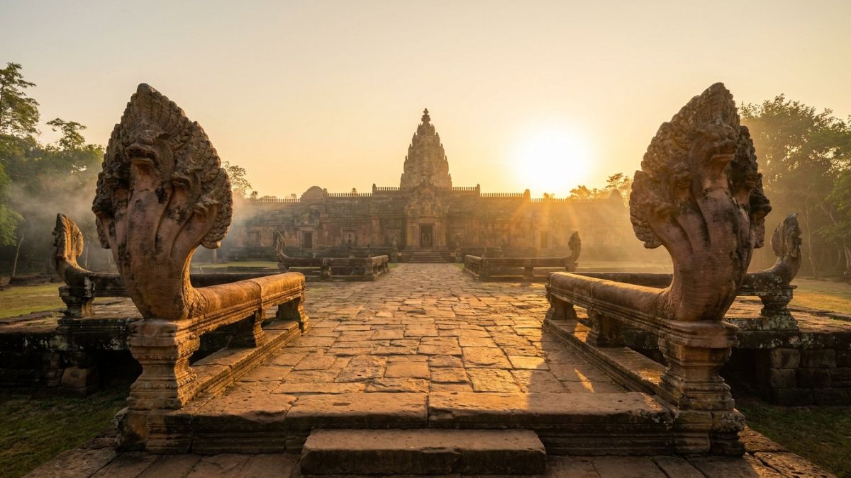
Isaan is Thailand’s northeast — roughly a third of the country’s land area, home to a third of its population, and, by most counts, the region least visited by foreign tourists relative to its size. The reason isn’t lack of substance. Prasat Hin Phimai, a Khmer temple complex in the town of Phimai (about an hour from Nakhon Ratchasima, known locally as Korat), predates parts of Angkor Wat and follows the same architectural cosmology — towers, causeways, naga-guarded bridges — without the crowds.
An hour and a half further south in Buriram province, Phanom Rung sits on the rim of an extinct volcano; four days a year, the rising sun aligns through all fifteen of its doorways in a straight line, drawing a genuine crowd, but on any other morning you might share the site with a handful of Thai families and nobody else. Down the hill, Prasat Muang Tam adds four lotus-filled pools and quieter, more intimate carving work.
None of this requires a guide. Rent a car or motorbike in Korat, Buriram, or Surin — the roads to both major sites are in good condition and load fine into Google Maps — or base yourself for a night in Nang Rong, the small town between the two temple clusters, which puts you close enough to catch both at the light-and-shadow hours (early morning or the last two hours before sunset) when the sandstone actually looks like something rather than just a historical marker under midday glare.
Isaan’s other identity is the Mekong. Chiang Khan, in mountainous Loei province, is a wooden-shophouse riverside town popular with Thai weekenders and almost unknown to foreign travelers — walk the riverside path at dawn and you’ll mostly see monks on their alms round and mist over the water toward Laos. Nong Khai, further along the river, has the Thai-Laos Friendship Bridge and Sala Kaew Ku, a genuinely strange sculpture park of enormous concrete Buddhist and Hindu figures built by a self-taught mystic in the 1970s.
The food alone is worth the detour — Isaan cuisine (som tam, larb, sticky rice, grilled river fish) is hot-sour-fermented and distinct from anything you’ll eat in Bangkok or Chiang Mai, closer in spirit to Lao cooking than central Thai.
Getting there and around: Overnight sleeper trains run from Bangkok to Nakhon Ratchasima and on to Nong Khai (the Nong Khai line takes roughly 10–11 hours; book the sleeper for comfort). From Korat, Buriram, or Surin, you’re on your own wheels for the temple circuit — there’s no reliable public transport directly to Phanom Rung. Budget: a rental car runs 800–1,200 THB a day; guesthouses in temple towns and Chiang Khan are frequently under 800 THB a night.
Current safety note: Stick to Phimai, Phanom Rung, and Muang Tam. Skip Prasat Ta Muen Thom and any site directly on the Cambodian border for now — see the safety section above.
Nan Province: The Kingdom That Kept to Itself
Good for: slow travelers, cyclists, couples wanting genuine quiet, photographers
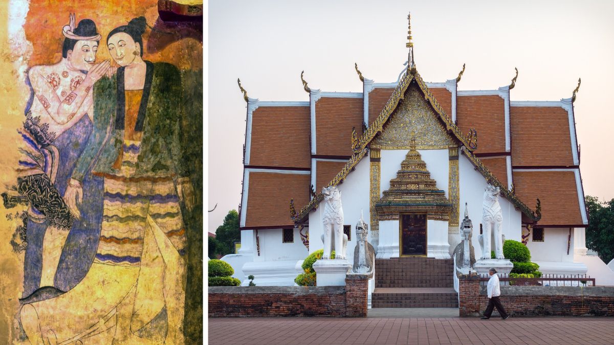
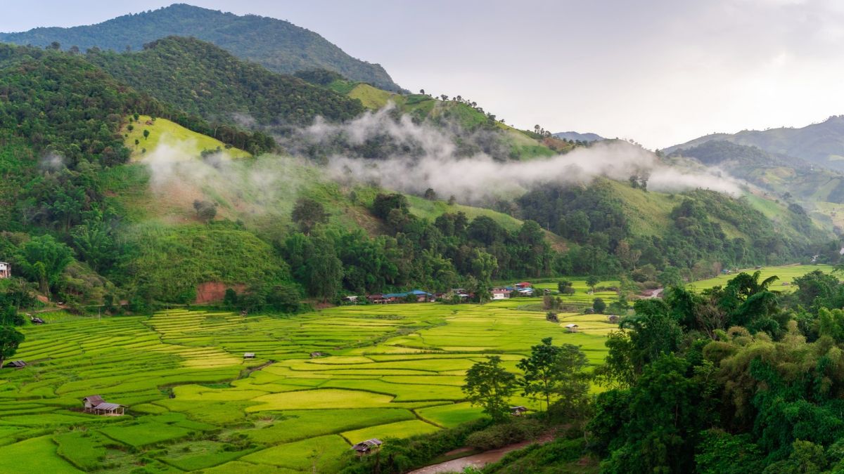
Nan stayed a semi-autonomous kingdom until 1931, later than almost anywhere else in modern Thailand, and its isolation shows up less as backwardness than as a slightly different culture that never fully merged with the mainstream — Tai Lue weaving traditions, its own temple mural style, and a pace of life that Chiang Mai and Pai gave up years ago. It’s about 320km — roughly four hours by road — east of Chiang Mai, far enough that most travelers simply don’t bother, which is precisely the point.
The town of Nan centers on Wat Phumin, whose 16th-century murals depict everyday Lanna life rather than religious grandeur alone, including the “whispering couple” panel that’s become a minor icon of Thai art. Outside town, Doi Phu Kha National Park climbs to nearly 2,000 meters and shelters the rare pink-blooming Chomphu Phu Kha tree, best seen in February.
A two-hour drive from Nan town, the village of Bo Kluea has mined salt from underground brine wells for roughly 800 years — one of the only places left in Thailand where you can watch the process — and the surrounding valley is dotted with Tai Lue weaving villages worth a slow afternoon. Sao Din Na Noi, a badlands landscape of red laterite pillars eroded by water over centuries, glows orange at sunrise and sunset and doubles as your entry ticket to Doi Samer Dao, a bald mountaintop that’s become one of the better stargazing spots in northern Thailand, largely because there’s so little light pollution for hundreds of kilometers around.
Nan has also, somewhat unexpectedly, become a serious cycling destination — the roads are quiet, the mountain passes are real climbs, and the annual Nan Challenge race draws competitive cyclists from Bangkok. Even a casual rental bike through the rice paddies outside town is one of the more peaceful hours you’ll spend in the country.
Getting there and around: Nok Air and AirAsia fly directly into Nan Nakhon Airport from Bangkok and Chiang Mai. If you’re driving the scenic route, plan on four days minimum for the “Nan Loop” from Chiang Mai via Phrae — fuel stations thin out past the main highways, so fill up whenever you see one. Best season is November–February (10–25°C); avoid February–April, when agricultural burning fills the valley with haze that can significantly cut visibility and air quality.
The Mae Hong Son Loop: 600 Kilometers of Mountain Road
Good for: confident motorbike riders, couples and small groups with a rental car, multi-day road-trippers
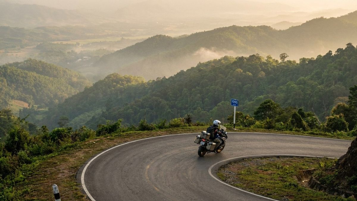
This is the one entry on this list you’ll find well documented — the Mae Hong Son Loop is famous within backpacker circles as Southeast Asia’s best motorbike road trip. I’m including it anyway because “famous within backpacker circles” and “genuinely crowded” are different things: away from Pai itself, which has become a scene in its own right, the loop’s other towns still feel like actual places rather than stage sets.
The full circuit runs Chiang Mai–Pai–Mae Hong Son–Mae Sariang (or the alternate route via Mae Chaem)–Chiang Mai, roughly 600km, with the Chiang Mai–Pai–Mae Hong Son stretch alone containing a locally famous 1,864 curves — nobody seems entirely sure who counted, but the number is official enough that the Mae Hong Son Chamber of Commerce hands out a completion certificate for 60 baht and a cup of local coffee.
Khun Yuam, a small town roughly midway between Mae Hong Son and Mae Sariang, holds a genuinely worthwhile WWII museum documenting the Japanese army’s use of the town as a supply base during the failed campaign into Burma. Mae Sariang itself, on the Yuam River near the Myanmar border, is the loop’s quiet counterweight to Pai — wooden shophouses, a slow riverside evening, and a fraction of the foreign visitors.
Route 4009, a newer paved side road out of Khun Yuam, is a detour worth knowing about if you’re comfortable on a bike: steep, switchback-heavy, close to empty of traffic, and not something the well-worn guides tend to mention. Fuel thins out on the smaller connecting roads — carry enough to reach the next town, since some stretches rely on roadside vendors selling petrol from glass bottles rather than actual stations.
Getting there and around: Rent in Chiang Mai — a decent 125–150cc automatic scooter runs roughly 200–300 THB a day, though the mountain grades genuinely favor something with more power if you’re riding two-up. You legally need an international driving permit with a motorcycle endorsement; police checkpoints do happen, most commonly near Pai.
If you’d rather not ride, minivans connect the loop’s towns on a limited daily schedule, and a rental car handles the whole route comfortably, just without the same sense of exposure to the scenery. Budget 5 days as a realistic minimum, 7–10 if you want time to actually stop rather than just pass through. Best season: November–February, avoiding both peak monsoon (June–October, when landslides are a real possibility on some stretches) and the worst of March–April’s burning haze.
Checkout our detailed Loy Krathong Mae Hong Son Loop Post.
Sangkhlaburi and the Mon Bridge
Good for: a 2–3 day add-on to Kanchanaburi, couples and families comfortable with a long travel day, cultural travelers
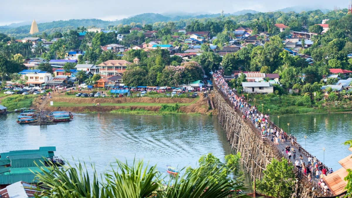
Sangkhlaburi sits at the literal end of the road — a single 200km route northwest from Kanchanaburi town, with no loop back and nowhere further to go except the Myanmar border itself. That dead-end geography is exactly why it stays quiet: there’s no reason to pass through Sangkhlaburi on the way to anywhere else, only a reason to go there specifically.
The town’s centerpiece is the Mon Bridge (Saphan Mon, formally Uttamanusorn Bridge), a roughly 400-to-450-meter handmade wooden footbridge — the longest of its kind in Thailand and the second-longest in the world after Myanmar’s U Bein Bridge — connecting the Thai side of town to Wang Kha, a village on the far bank built by Mon refugees who fled Burma decades ago.
Go before dawn: around 6:30am, a line of saffron-robed monks crosses the bridge to collect alms from the Mon community, and the light through the mist off Vajiralongkorn Lake (formally Khao Laem) is the kind of thing that photographs itself. The lake is itself a manufactured reservoir — a 1980s dam submerged the original town, and depending on water levels, you can still see the wooden frame of a flooded temple breaking the surface, reachable by longtail boat tour.
Twenty kilometers further on sits Three Pagodas Pass, an official Thai-Myanmar border crossing marking a historic invasion route between the two countries, with a small souvenir market and a direct view into the Burmese town of Payathonzu on the other side. I’d treat this as a bonus rather than a plan: border crossing hours and access can change on short notice given the broader regional situation on the Myanmar side, so confirm current status locally before building your day around it rather than assuming you’ll get across.
Getting there and around: Direct buses run from Bangkok’s Mo Chit Northern Bus Terminal (roughly 7–8 hours), or break the trip at Kanchanaburi town first and continue by local bus (about 130 THB, 5 hours) or private minivan (roughly 180 THB, faster and more frequent, running hourly through the day). There’s no realistic way to see Sangkhlaburi as a day trip from Bangkok — plan on at least one overnight, ideally two.
Um Phang and Thi Lo Su Waterfall
Good for: independent travelers with real flexibility, adventure-minded couples and small groups — I’d think twice about this one with young children or on a tight schedule
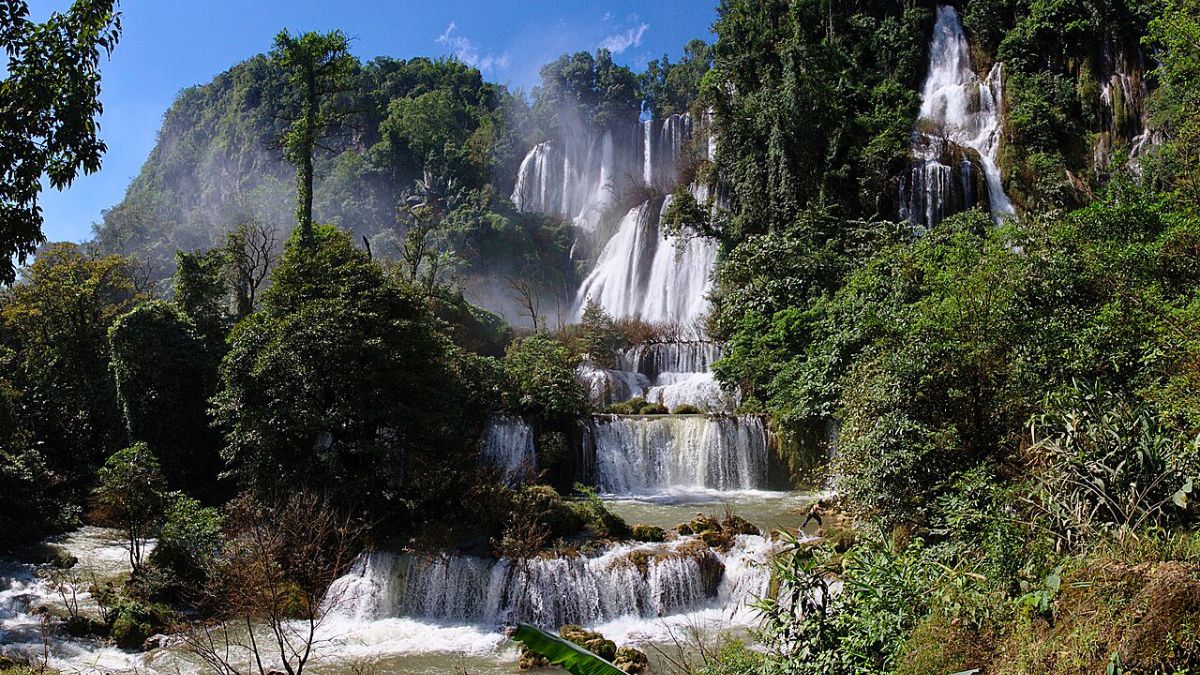
I’ll be direct about this one: Um Phang is genuinely remote, and getting to Thi Lo Su — widely considered Thailand’s largest waterfall, dropping roughly 250 meters across a face nearly 450 meters wide — takes real effort. That effort is also exactly why it stays so quiet relative to how spectacular it is.
The journey starts in Mae Sot, a Thai-Myanmar border town reachable by a roughly one-hour flight from Bangkok or Chiang Mai, or an 8-to-8.5-hour bus from Bangkok’s Mo Chit terminal. From Mae Sot, Highway 1090 runs about 164km south to Um Phang village — a road so consistently switchbacked that locals count 1,219 curves and call it either the “Sky Road” or, less charitably, the “Death Highway.” It’s a spectacular but genuinely demanding drive, roughly four to five hours by songthaew or private car, and worth stopping midway for the views alone.
Um Phang village itself has minimal tourist infrastructure — basic guesthouses, limited ATM access, and not much to occupy you beyond arranging your onward trip to the falls, which is really the point of coming. In dry season (roughly November–May), you can drive most of the way to a campsite near the falls and walk the final 1.5km on a paved trail, though the unpaved final stretch demands a high-clearance vehicle and gets genuinely rough.
In wet season, road access becomes unreliable, and the classic route is a three-hour inflatable-raft trip down the Mae Klong River through the jungle, passing hot springs and smaller falls, followed by a 4×4 transfer and a short walk — an experience most people describe as the highlight of the whole trip, not just a means of transport. The trade-off: dry season gives you easier access and clearer water; wet season (roughly June–November) gives you dramatically more water volume and a genuinely different waterfall, at the cost of a harder journey to reach it.
Most independent travelers book a two-to-three-day rafting-and-trekking package locally in Um Phang or Mae Sot rather than trying to freelance the logistics — this isn’t a case of a tour company selling you something you could easily do alone, it’s closer to how you actually get there. Local operators run trips combining the raft descent, a night camped near the falls or in a Karen village, and a jungle trek out. Multi-day packages run roughly 3,000–5,000 THB per person depending on group size and season.
Getting there and around: Fly or bus to Mae Sot, then songthaew or private transfer to Um Phang (about 4–5 hours). Book your falls package in Mae Sot or on arrival in Um Phang. Give this at least three days total from Mae Sot and back; two nights minimum in the Um Phang area if you’re doing the full rafting route.
Koh Kood and Koh Mak: The Trat Archipelago
Good for: couples, families wanting a quiet beach without nightlife, anyone burned out on Koh Phi Phi crowds
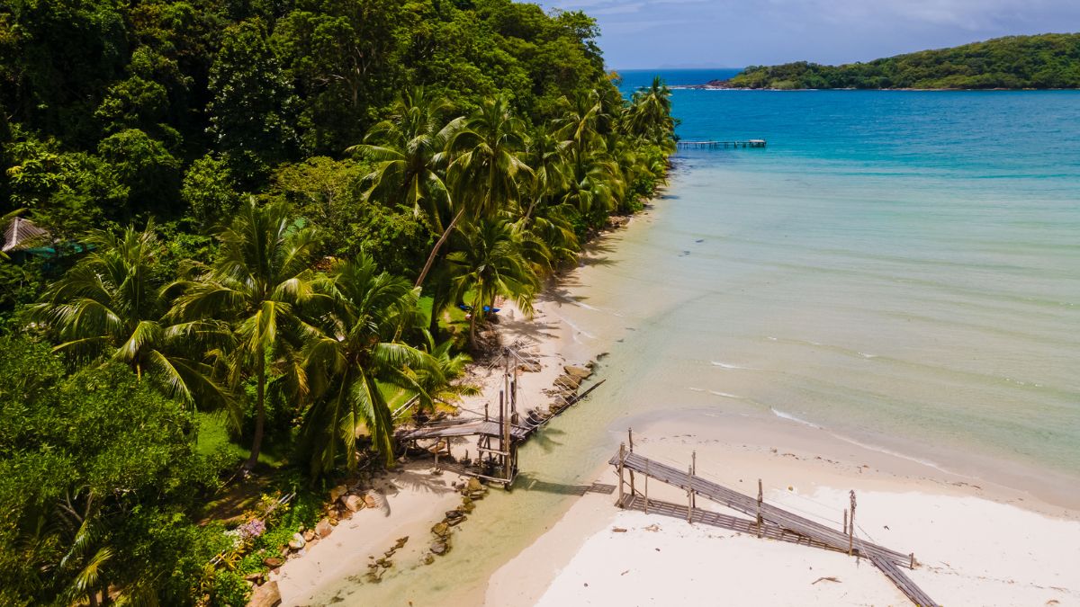
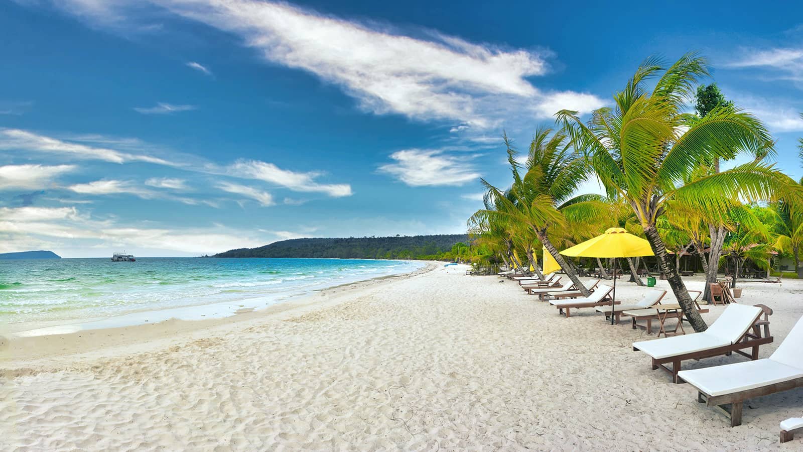
Koh Kood is Thailand’s fourth-largest island and has no airport — the only way in is by boat, which is precisely what has kept it from becoming Koh Samui. Boonsiri, Koh Kood Express, and Seudamgo all run high-speed catamarans and speedboats from Laem Sok Pier on the mainland (about 30km, roughly an hour’s drive, from Trat town), taking anywhere from 40 minutes to 1.5 hours depending on operator and boat type, for around 500–600 THB one-way.
Once you’re there, the island itself has no vehicle ferry access at all — everything moves by motorbike, songthaew, or your resort’s own transport. Klong Chao Beach is the main stretch of sand, with a genuine waterfall a short walk inland where you can swim in a freshwater pool; quieter fishing villages sit at both ends of the island if you want a couple of hours away from any beach at all.
Koh Mak, a short hop further south, is smaller, flatter, and even quieter — a former coconut plantation island with good cycling roads, no real nightlife, and a deliberately low-key development approach that’s kept it from following Koh Chang’s trajectory. Ferries run from Laem Ngop Pier (a separate mainland departure point from Laem Sok) or connect onward from Koh Kood, though be aware that direct inter-island ferries between Koh Kood and Koh Mak run seasonally, generally November through April, thinning out or stopping in the wet months.
Getting there and around: Fly Bangkok–Trat (about an hour) then transfer to Laem Sok Pier, or take a direct bus or minivan from Bangkok all the way to the pier (roughly 6–7 hours total). Most ferry operators include a hotel shuttle on both ends. Budget guesthouses on both islands run from around 1,000 THB a night; boutique beachfront options go considerably higher.
Current safety and insurance note: Koh Chang, Koh Kood, and Koh Mak fall within the 50km advisory radius tied to the Thailand-Cambodia border situation described above, even though they’ve experienced zero disruption — ferries, hotels, and daily life are all operating normally as of this writing. The practical issue is insurance, not safety on the ground: confirm your travel insurance actually covers a destination inside a government advisory zone before you book, since some standard policies exclude it on paper regardless of real conditions.
See our destailed guide to Thai Island Hopping for independent travelers
Koh Libong and Koh Sukorn: The Trang Islands’ Quiet Corner
Good for: nature-focused travelers, families comfortable with basic infrastructure, anyone chasing a specific wildlife encounter rather than a beach club
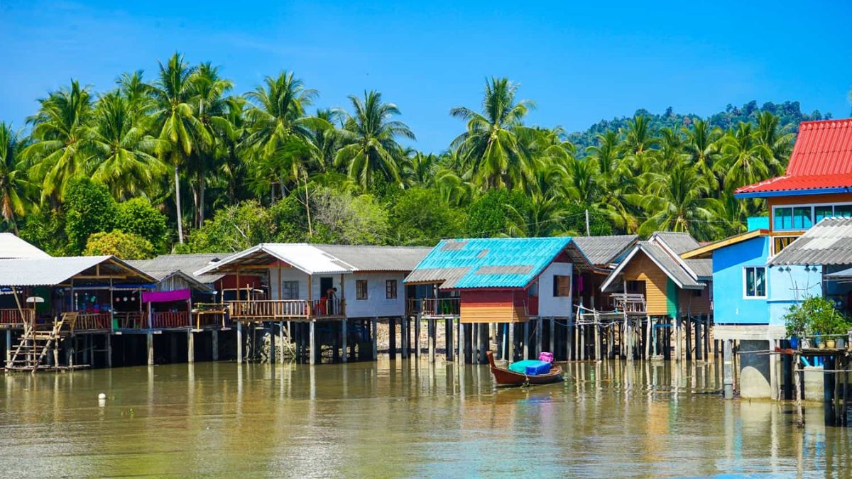
Trang’s islands sit far enough south on the Andaman coast, and far enough off the Phuket–Krabi ferry circuit, that most travelers skip the province entirely on the way to somewhere more famous. That’s the whole appeal of Koh Libong: it’s the largest island in Trang province, and also one of the least developed, home to a Muslim fishing community for whom tourism is a genuine sideline rather than the main economy.
The reason to come is Thailand’s largest population of wild dugongs — the marine mammal sometimes called a sea cow — which graze the extensive seagrass beds around the island year-round, since dugongs here aren’t migratory. Local estimates put the population at roughly 100 individuals, the country’s healthiest concentration by a wide margin.
The most reliable viewing spot is a four-story observation tower at the end of a roughly one-kilometer pier in the fishing village of Ban Batu Bute, best visited at high tide in calm, clear conditions, with morning generally considered the better window since dugongs feed most actively then. Sightings aren’t guaranteed — most operators and rangers put the odds at somewhere around one in three on any given outing — but the village itself, its mosque, and the walk out along the pier are worth the trip regardless of whether a dugong shows.
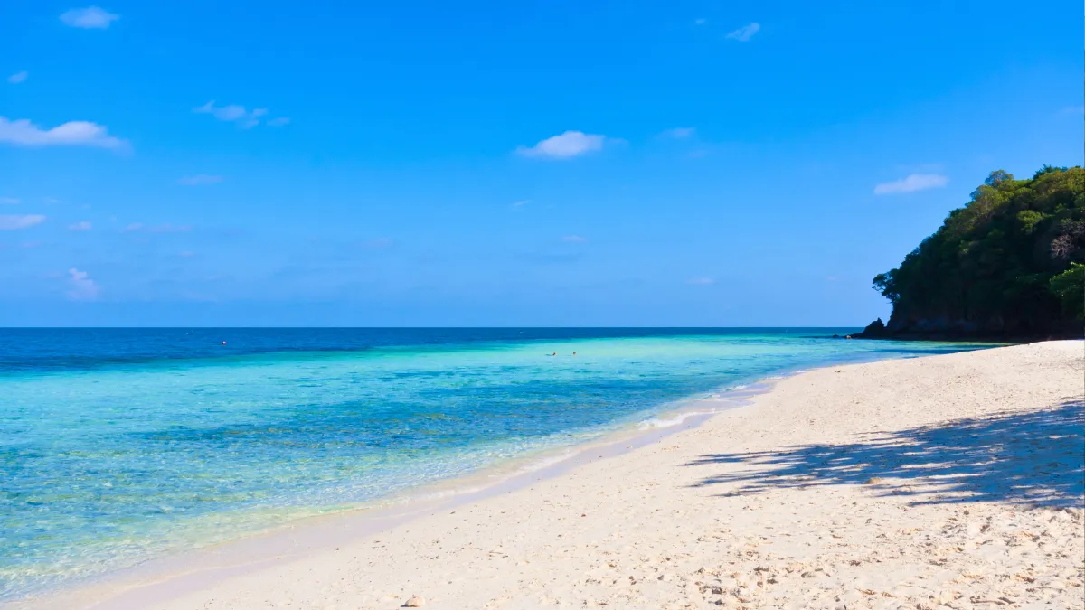
Beyond dugong-watching, Koh Libong has genuinely empty beaches (they’re a slightly less turquoise ochre than the postcard sand on neighboring Koh Kradan or Koh Ngai, which is part of why it stays quiet), mangrove trekking, and strong birdwatching in March and April when migratory species pass through on the mudflats.
Koh Sukorn, further south still and reached via a separate pier, is quieter yet — a small, mostly agricultural island with minimal tourist facilities and correspondingly little to do besides exactly that.
Getting there and around: Fly into Trang Airport from Bangkock (roughly 1.5 hours), then a taxi or minivan to Hat Yao Pier (about 45 minutes) followed by a 20-to-45-minute longtail boat to Koh Libong. An overnight sleeper train from Bangkok to Trang (about 12 hours) followed by the same pier transfer is the slower, cheaper alternative. On the island itself, rent a motorbike (roughly 250–350 THB a day) — there are no taxis, and songthaews run limited routes. Bring more cash than you think you’ll need; ATM access is unreliable on both islands.
Putting It Together: Three Ways to Combine These
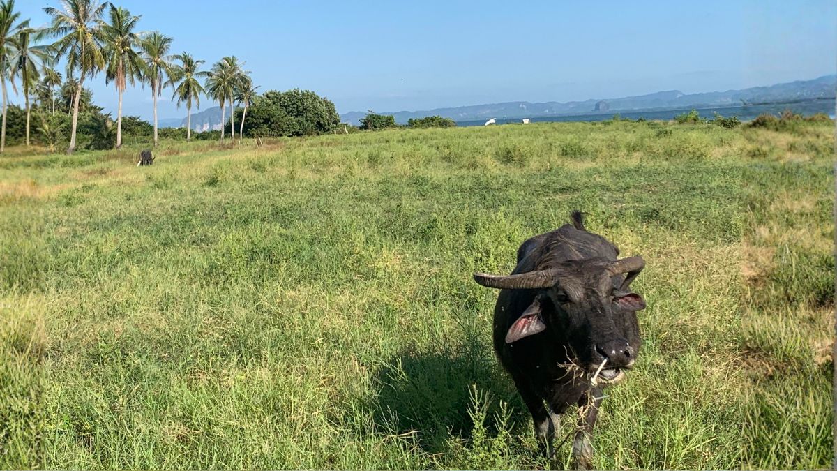
You won’t do all seven in one trip unless you have a genuinely open-ended schedule — the country’s geography works against it, since Isaan, the far north, and the Andaman coast are each a full day’s travel apart from each other. Here’s how I’d actually combine them.
Two weeks, north Thailand focused
Fly into Chiang Mai, spend one day organizing a bike, then run the full Mae Hong Son Loop (5–7 days) before continuing overland to Nan (roughly a day’s drive via Phrae, or fly back to Chiang Mai and connect). Close with three or four unhurried days in Nan itself. This keeps you in the cool north the whole trip and avoids doubling back.
Ten days, Thailand west and islands:
Start in Bangkok, take the train to Kanchanaburi, and continue to Sangkhlaburi for two nights. Backtrack to Bangkok (or fly from Trat instead, if you can find a connection) and finish with four or five days island-hopping Koh Kood and Koh Mak. This one has more backtracking built in, but it pairs a genuine cultural stop with a legitimately relaxing finish. see our western Thailand itinerary.
Two weeks, Isaan and Andaman:
Take the overnight sleeper from Bangkok to Nakhon Ratchasima or Buriram, spend three or four days on the Khmer temple circuit and a Mekong town or two, then fly from Ubon Ratchathani or back through Bangkok down to Trang for a final week split between Koh Libong and Koh Sukorn. This is the most geographically ambitious combination in this list, and the one that shows you the widest range of what the country actually looks like outside its resort corridor.
Frequently Asked Questions
Is it safe to travel independently in these regions without a Thai-speaking guide?
Yes, for all seven — none of them require a guide for basic navigation, and English signage exists at major sites, train stations, and bus terminals, even if it thins out in village-level guesthouses and food stalls. A translation app covers the gaps. The one place I’d genuinely consider a local guide worthwhile, rather than just convenient, is Um Phang’s rafting route to Thi Lo Su, mainly for river safety and because most independent travelers end up booking the trip that way regardless.
How much should I budget per day outside the major tourist areas?
Expect meaningfully less than Bangkok or Phuket prices. A guesthouse room in Nan, Isaan, or the Trang islands commonly runs 500–1,000 THB; street and market food is 40–100 THB a dish; a full day of motorbike rental is 200–350 THB. A reasonable independent daily budget across these regions, excluding long-distance transport, sits somewhere around 1,200–2,000 THB per person for comfortable-but-simple travel.
Do I need an international driving permit to rent a motorbike?
Legally, yes — an international driving permit with a motorcycle (category A) endorsement, obtained in your home country before you travel, alongside your regular license. Enforcement varies a great deal by location, but riding without one can void your travel insurance if you’re in an accident, which is the part that actually matters.
What’s the single biggest planning mistake for a Thailand off the beaten path trip?
Underestimating transit time between regions. Thailand looks compact on a map, but Isaan, the far north, and the Andaman coast are each the better part of a day apart from one another by any transport method. Pick one or two regions per trip rather than trying to string all seven together, and build in a full travel day rather than assuming you can sightsee and relocate on the same day.
Are these destinations suitable for families with kids?
Isaan’s temple circuit, Nan, and Koh Kood/Koh Mak all work well for families — the pace is gentle and infrastructure is reasonable. Koh Libong is genuinely good for kids with an interest in wildlife, though facilities are basic. I’d be more cautious with young children on the Mae Hong Son Loop by motorbike (a rental car handles the same route fine) and with Um Phang, where the travel time and physical demands of reaching Thi Lo Su are real considerations regardless of age.
Will I need to change my itinerary because of the Thailand-Cambodia border situation?
Only if your route runs through the immediate 10–50km border buffer along Sa Kaeo, Chanthaburi, Trat’s mainland districts, or the Isaan provinces of Buriram, Surin, Si Sa Ket, or Ubon Ratchathani. Phimai, Phanom Rung, Muang Tam, and the Trat islands are all outside or at the edge of that zone and unaffected in practice, though check current advisories before finalizing plans, and see the safety section above for the specific temple I’d skip for now.
Is Thailand’s visa situation actually settled right now?
Not entirely. The 60-day visa-free stay most Western travelers currently receive is scheduled to drop to 30 days, but as of this writing that change hadn’t yet taken legal effect. Check the current rule for your nationality in the weeks before you fly rather than trusting anything — including this page — written more than a month or two before your trip.
This guide is part of an ongoing series on independent travel in Thailand. Have a correction, an update, or a region you think belongs on this list? Send us a message via our contact page
6 Works Cited
Royal Thai Embassy. Visa Exemption by Nationality. 2026, wellington.thaiembassy.org/th/publicservice/19038-visa-exemption.
Shoji, Tomotaka. Thailand-Cambodia Border Conflict and ASEAN’s Limited Mediation Role. 2026, www.spf.org/iina/en/articles/shoji_25.html.
Thai National Parks. Species of Thailand, Dugong. 2026, www.thainationalparks.com/species/dugong.
Thailand Immigration. Official Thailand Digital Arrival Card. 2026, tdac.immigration.go.th/arrival-card/.
Wikipedia. 2025 Cambodian–Thai border crisis. 2025, en.wikipedia.org/wiki/2025_Cambodian%E2%80%93Thai_border_crisis.
—. Southern Thailand insurgency. 2026, en.wikipedia.org/wiki/Southern_Thailand_insurgency.